I’ve previously explored part of old the Princes Pier railway line in Greenock, including several tunnels. In this post I explore another part of the line, further east and seemingly not so well known amongst explorers as I haven’t seen many photos from here.

The layout of the railways and tunnels in the area is a bit complicated so I’ve included an old map from the excellent NLS Maps resource above. There are four tunnels in all, running through the ridge of high ground to the east of the Carts Burn. From the top these are: Bawhirley no. 1, which carried a mineral line that branched off the main Princes Pier line towards Port Glasgow; Bawhirley no. 2, which carried the main Princes Pier line; Cartsburn Up which is still in use today carrying the line between Whinhill and Bogston; and Cartsburn Down which is now disused since that line was singled.
Although Bawhirley (I’ve also seen it spelled “Balwhirley”, but I’m going with “Bawhirley” since that’s the name of the nearby road) no. 1 was originally the less important of the pair since it just carried a mineral branch, it later took on a new life when the western end of the Princes Pier line was converted to carry freight to the container terminal that replaced the old Princes Pier station in 1971. Instead of passing through Bawhirley no. 2 and using the whole of the original route via Kilmacolm and Bridge of Weir, the container line passed through the no. 1 tunnel instead, and a new connection was made to the Wemyss Bay line east of the tunnel.
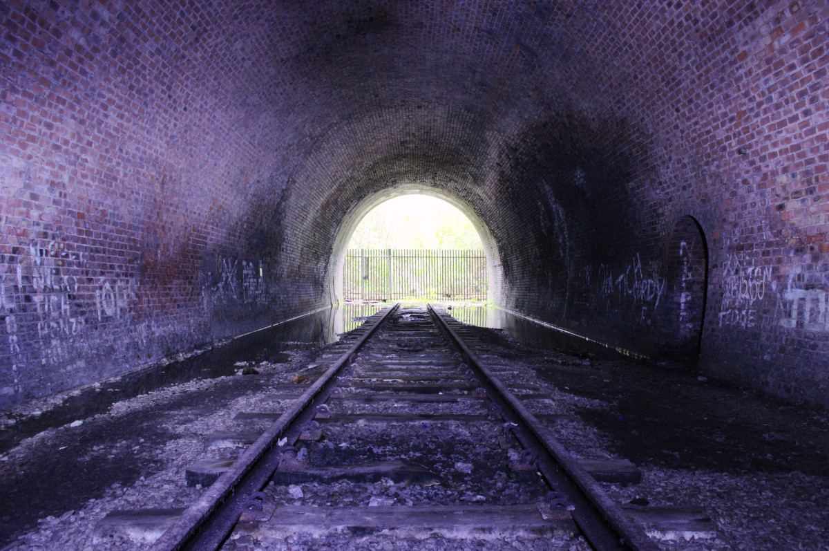
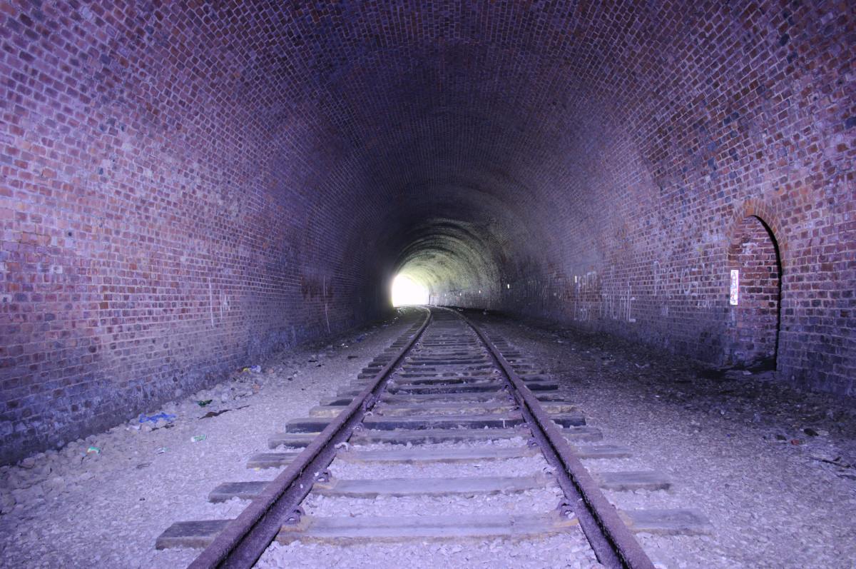
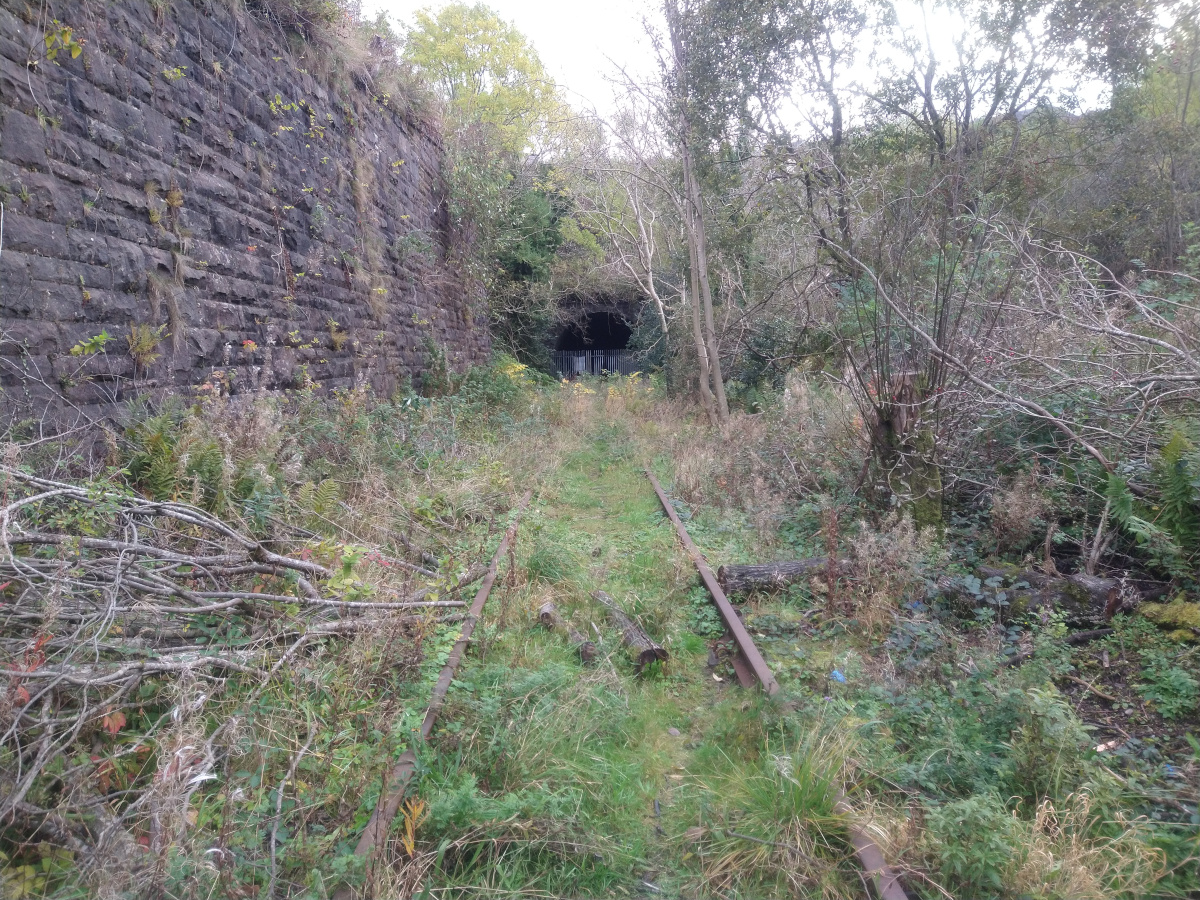
Although the tunnel was, like the others on the line, originally built to take a double track, the container line was laid as a single track down the centre so that there would be enough clearance for the large containers to pass through (although later on, as their size increased further, they became too big for the line and it was closed in 1991).
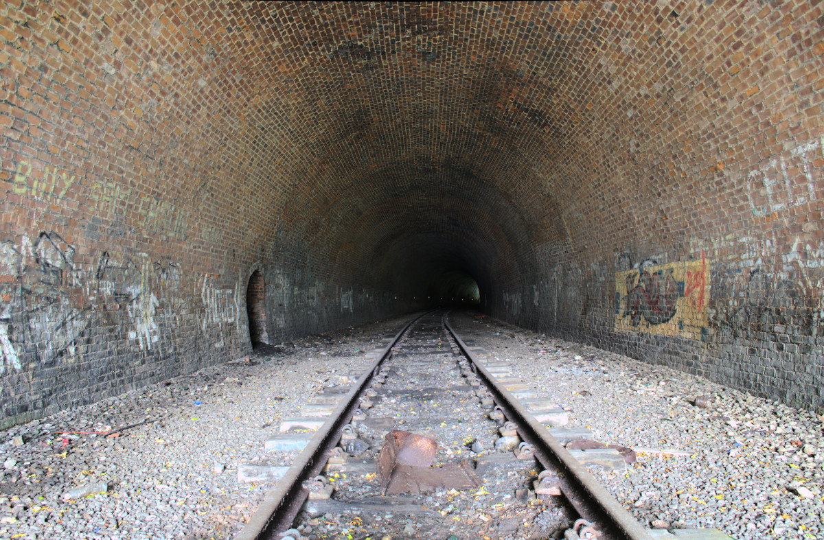
The single track through the tunnel still exists today, adding visual interest. There aren’t a lot of other features in there apart from the arched refuges in the side walls. I was struck by how good the condition of the lining seemed to be compared with most other tunnels I’ve explored. The bricks mostly looked clean and red and very little water was finding its way through. I wonder if this is because the tunnel was originally just a mineral branch line and didn’t get used by steam trains as much as the nearby main line tunnels?
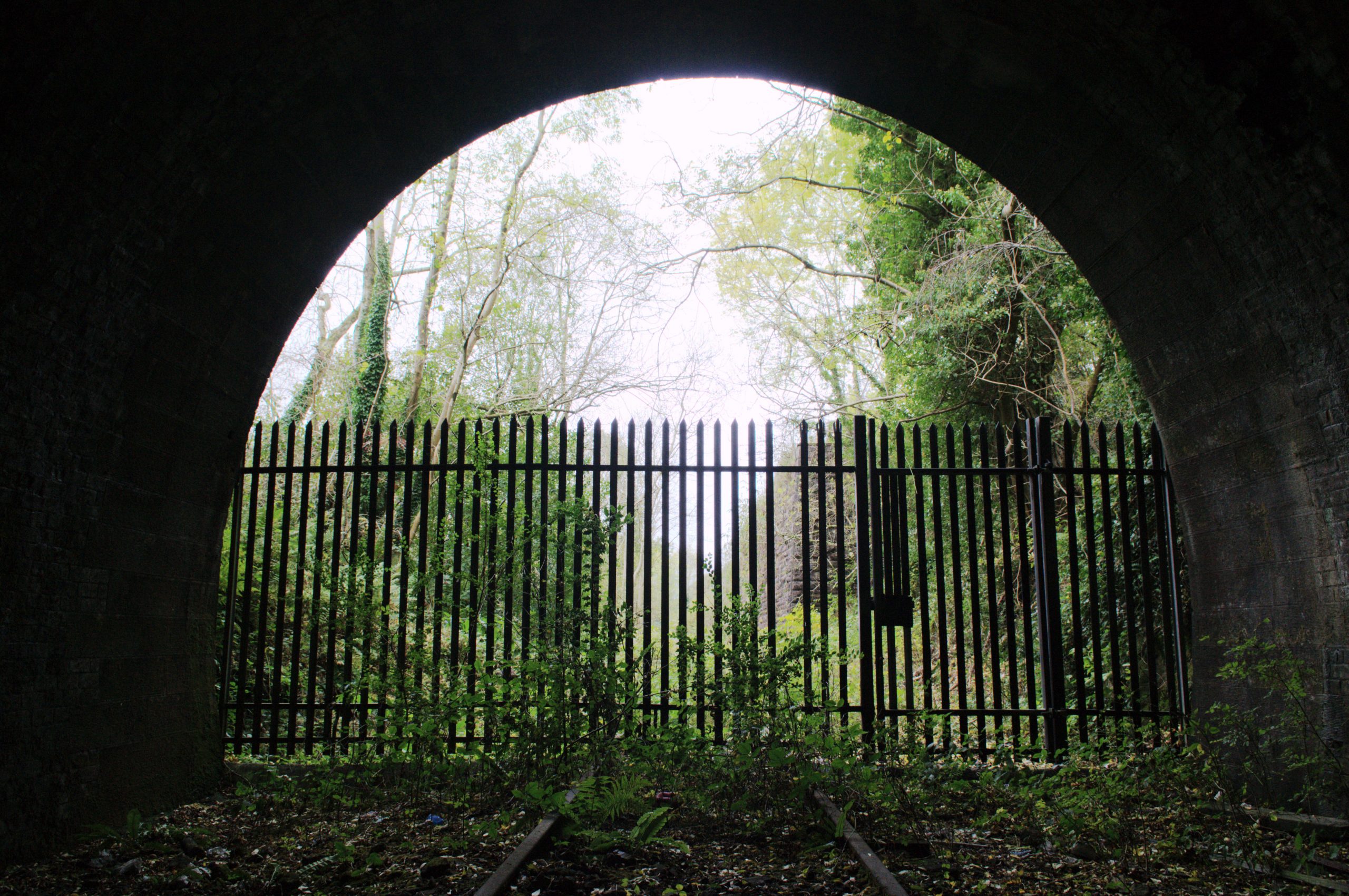
The approach cuttings at both ends are impressively deep and there is a huge stone retaining wall on the north side of the west approach. Although in a residential area, the cuttings are so deep and overgrown that it’s difficult to see the tunnel portals at all unless you enter the cuttings. As I walked through I found myself wondering if the residents of the streets up above actually know what lies underneath their houses.
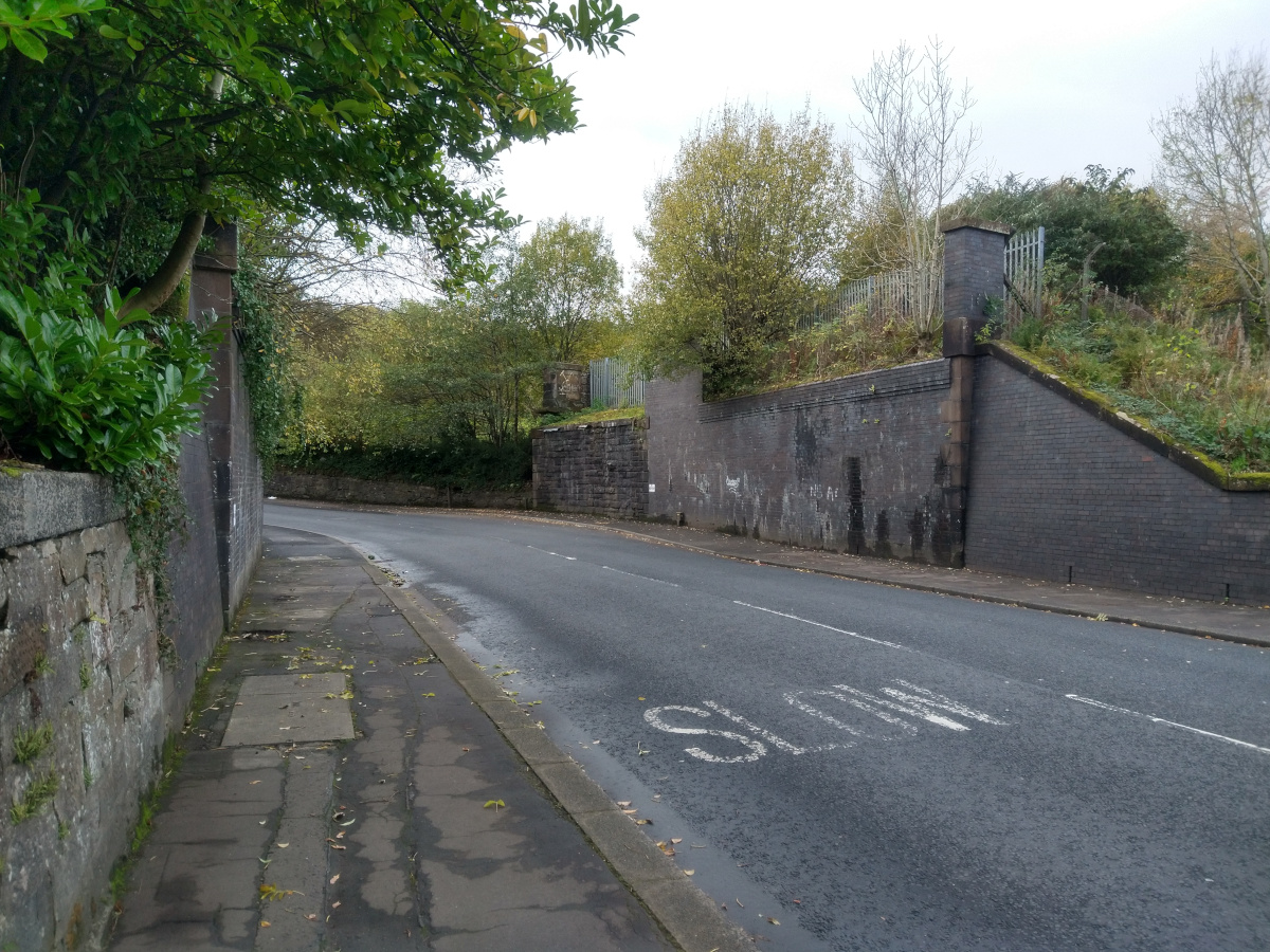
A little further along, the bridge over Kilmacolm Road has relatively recently been removed but the large brick and stone abutments remain. The whole area is full of interesting little bits and pieces of railway history if you know where to look for them.
All in all, this was a fun explore, even though I was only able to access one of the three disused tunnels in the area (Bawhirley no. 2 was more secure and Cartsburn Down is too close to the live railway and station for me to be comfortable attempting that one). I was also glad to find that despite my lockdown weight gain, I can still just about make it through a narrow gap when I need to.
Leave a Reply