(And St Vincent Crescent Tunnel).
In part 2, I followed the route of the disused Glasgow Central Railway on its mostly underground journey from Kelvinbridge to Kirklee. Part 3 covers the same line in the other direction, from Kelvinbridge to Stobcross (well, most of the way to Stobcross… we didn’t go quite all the way for reasons that will become clear later on). This took us through the 950 yard long Kelvingrove Tunnel, one of Scotland’s longest and another one that had been on my radar for a long time. We also saw the much smaller St Vincent Crescent Tunnel, at the south end of Kelvingrove. We didn’t pass the remains of any stations this time, but the tunnels themselves had more than enough interesting features to make this a very satisfying explore.
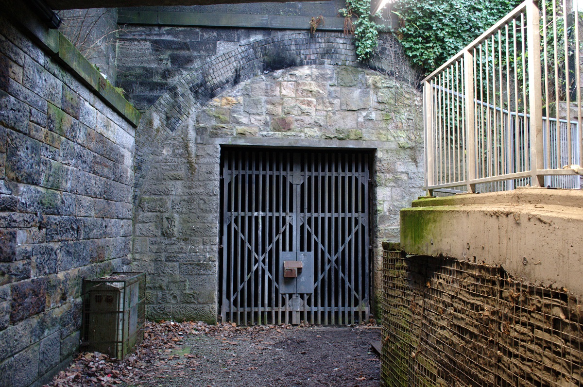
Kelvingrove Tunnel’s bricked up north portal can be seen near the River Kelvin, to the south of the former Kelvinbridge Station site. Most people who walk past here on the busy Kelvin Walkway probably have no idea they’re looking at the entrance to a 120 year old tunnel that runs right underneath Kelvingrove Park and surfaces the best part of a mile away to the south!
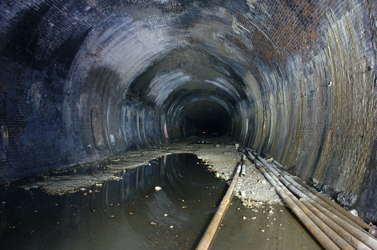
Inside, the tunnel is fairly wet but apparently nowhere near as wet as it used to be. This wetness caused major drama back in December 1994 when the River Kelvin burst its banks and water surged through the disused tunnels, eventually reaching the still-active part of the Glasgow Central line and flooding Central Low Level Station. Since then, remedial work has been carried out to prevent a repeat of this incident, including partially backfilling the south end of the tunnel, as well as putting in a higher bank outside the Kelvinbridge portal.
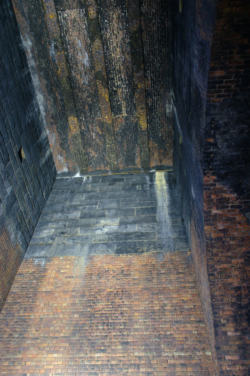
About halfway along the tunnel, the bore opens out briefly into a large square shaft, presumably a former ventilation shaft. It’s now capped off at the top and we were unable to find any trace of it on the surface (the tunnel is passing underneath Kelvingrove Park at this point).
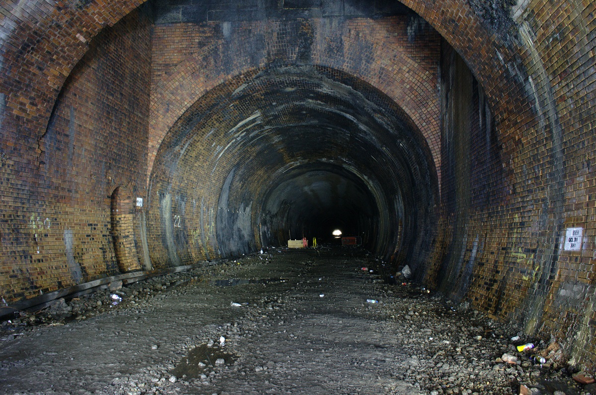
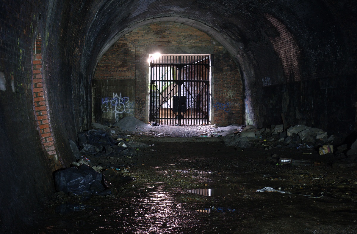
The photo above shows the view looking south with the shaft in the foreground and the light of the south portal visible in the distance. Apart from a bend at the north end, the tunnel is dead straight so the south portal can be seen from several hundred yards away. The wooden thing in the middle distance, surrounded by empty drinks cans, may be a relic from the days when the tunnels were less well secured and used to play host to illicit raves. Sadly, though, the incongruous sight captured by past explorers of two Ikea easy chairs sitting in the middle of the dark, damp, derelict tunnel is no more – we didn’t see the chairs at all on our visit, so they must have been removed.
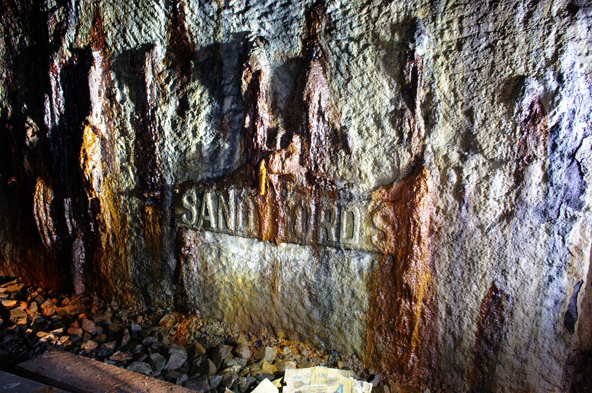
Towards the south end, this old street sign (similar to the Bank Street one under Great Western Road) survives, though is now encrusted with the calcite that runs down the tunnel walls at this point. This confused us at first as we couldn’t find a street of that name anywhere near the line of the tunnel, but after some research it turns out that the western part of Sauchiehall Street (from Kelvingrove Street onwards) used to be called Sandyford Street until around 1900.
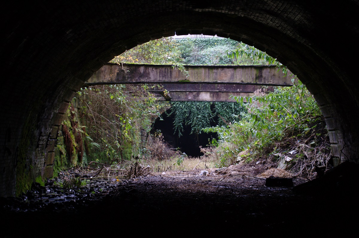
The south portal of the tunnel opens into a very short, steep-sided cutting. It’s been re-inforced with metal braces up above. The entrance to St Vincent Crescent Tunnel can be seen at the far end of the cutting.
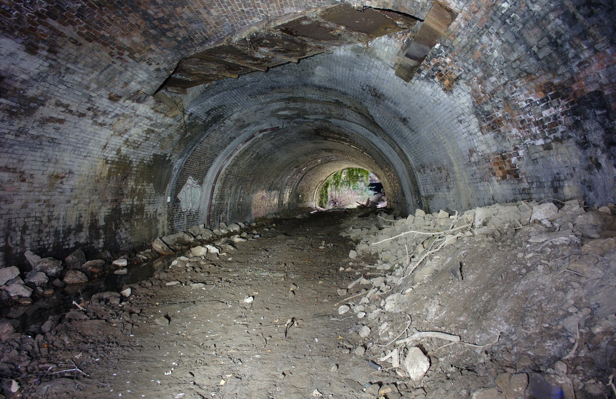
This much shorter tunnel, only around 80 yards long, takes the old line underneath the street of the same name. This whole tunnel (along with the south end of Kelvingrove) has been partially backfilled so the roof seems much lower than it originally would have. The roof is also crossed by two metal aqueducts, probably carrying sewers or water mains, one of which can be seen in the photo above.
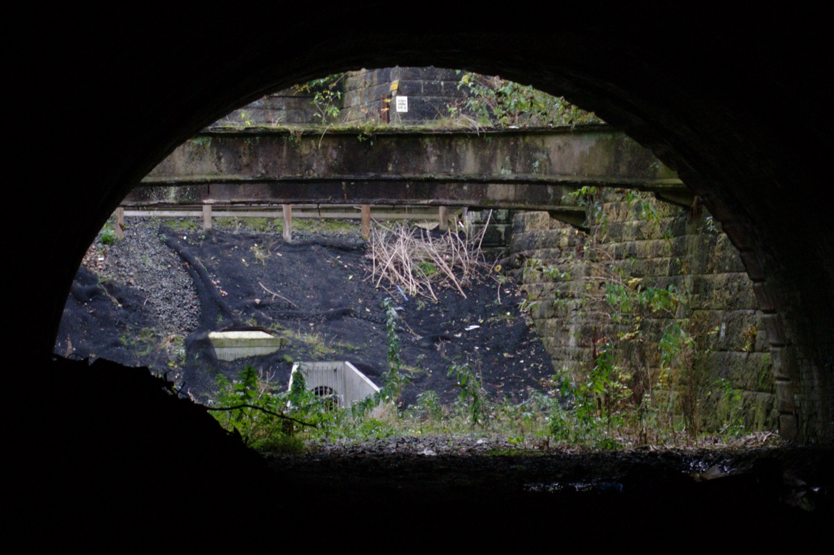
St Vincent Crescent Tunnel opens out into another short, steep cutting, but this was as far as we went – a live railway line now crosses the cutting on an embankment, and we had no wish to risk getting hit by a train or fined for trespassing on the tracks. Before the flood prevention works, the cutting floor was lower and there was a bridge here. At the far end of the cutting, the Glasgow Central Line enters yet another tunnel, the Stobcross Depot Tunnel. Inside this tunnel, the disused line joins onto the current Argyle Line (a section of the Glasgow Central Railway that was reopened in 1979), so I wouldn’t have entered that one even if the cutting wasn’t blocked.
On a more personal note, Kelvingrove Tunnel made me feel more uneasy than any other I’ve been in, mainly because of the noises – on the way in I was convinced someone was in there due to the loud clanking noises coming from up ahead, which turned out to just be drops of water falling onto a piece of discarded metal. Coming back out was even worse as we could hear voices and it sounded as if there must be people in the tunnel with us. Though we didn’t pass anyone, so either they went back out again before meeting us, or the voices were just filtering in from the park outside and sounding closer due to the weird acoustics in the tunnel. Anyway, it was all worth it to see this place!

[…] instead. Wandered round Kelvinbridge and found evidence of an old railway line which is detailed here. Lovely sunset and great lighting on the old Lansdowne church. I even managed to get a bit of a […]
Hi,
I have enjoyed reading all yours posts and you have given me some great ideas for future days out.
Over a month ago I enjoyed the Botanic Garden Station and tunnel, we found it relatively easy to gain acces from Kirklee and exited at Kelvinbridge.
It was a great adventure and I’m keen to do more, in particular the Kelvingrove Tunnel. Entry or exit from Kelvinbridge looks impossible and therefore the only way I can see in is from St Vincent’s Terrace. From what I can asses there are two options, one would be over a fence and along the live railway line, I don’t fancy either being hit by a train or arrested for trespassing. The second option is to climb down what looks like climbing down cabling that looks like a ladder. I am just not confident of not slipping and breaking parts of my body.
Could you advise me of a third more accessible option, I would appreciate any advise you could give me?
[…] never explored a tunnel with open shafts before (though Kelvingrove had a very impressive capped shaft), so it was interesting to see them from below. The bases of the […]
This is a great write-up, thanks for sharing it.
This tunnel is something of a nemesis for me, since I’ve never been able to get into it. So it was nice to see the photos from someone who had!
One day I will find a way! 😀
Hi
I have been exploring some of these tunnels myself, and was in the Botanics tunnel 2 nights ago. It’s a good one. However, the really solid fence and live railway line issue has always put me off this tunnel. Any advice on how to access?
Fascinating tour. Thanks.
Hello, I’ve been very curious about these tunnels for some time now and am determined to get in. I am only visiting though, and would have to take a train, or subway from Edinburgh. Do you have an address of any buildings near the easiest entrance that I could use for reference? Or would you happen to know what station I should get off at so I can finish exploring on foot?
Unfortunately there’s no easy way in that I know of right now. Security has been increased in the few years since I wrote these blog posts… there’s now a solid metal gate blocking the access to Kelvingrove Tunnel. Botanic Gardens was open for a while last year but is now sealed up again with new fences and razor wire 🙁 .
hi there, was just wondering if botanics tunnel and this tunnel are still accesible, i was having a look last week and kelvinbridge station was open but the tunnels wernt
I don’t think they are, unfortunately. Security has been increased quite a bit since I last explored them.
The botanical tunnel is open now at Kirklee
Hi all
Can someone please outline where I can again access to this tunnel from kirklee. I would deploy appreciate simple directions.
Kind regards
Khurram
Can you give more precise details on how to see the section at St. Vincent Crescent. I couldn’t find it.
You can see down into the cutting at the north portal from this little lane here: https://www.google.co.uk/maps/@55.8641733,-4.2846824,3a,74.5y,34.08h,85.77t/data=!3m6!1e1!3m4!1suxvlWaM-HF5gBaUMzAGnCw!2e0!7i13312!8i6656
And you can see the cutting at the south portal from St Vincent Crescent itself here:
https://www.google.co.uk/maps/@55.8637505,-4.2847061,3a,75y,187.94h,96.36t/data=!3m6!1e1!3m4!1sJi7d3ZrfTa8c0VZ9eZJEGg!2e0!7i16384!8i8192
The railway line from Partick to Charing Cross also goes right past the south portal so you can see it from the train.